Federal Lands in Arizona
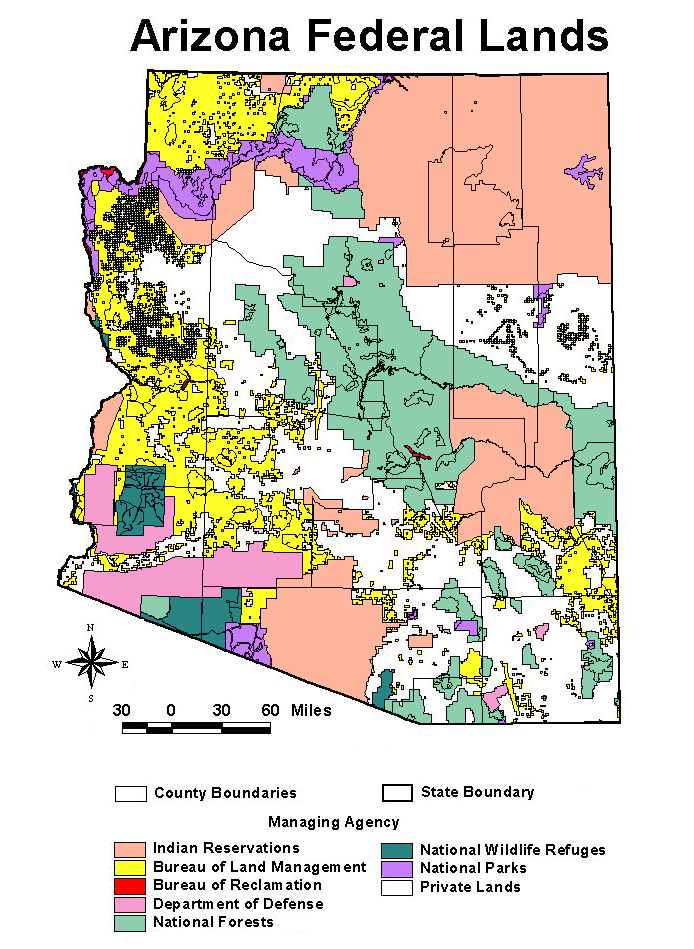
The map above was developed in the ASU Libraries' Map Collection
using ArcView, a geographic information system software, and data from
ESRI and the US Geological Survey. For more information about GIS in the
Map Collection, visit the GIS
in the ASU Libraries Map Collection or the Map Collection's home
page.
To print the image:
- Place the cursor on the image below and click the RIGHT mouse
button.
- Select the View Image option. The entire image will fill up
the screen.
- Choose Print in the File menu above. The Print Menu
will appear.
- Click on the Properties button and set the paper size to Landscape.
Click OK.
- Click on the OK button on the print page to send the image
to the printer.
GO TO:
ASU
Libraries' GIS Home Page
ASU
Libraries' Map Collection Home Page
For more information on materials in the ASU Libraries' Map
Collection, please contact:
Map Collection
Noble Science and Engineering Library
Box 871006
Arizona State University Libraries
Tempe, AZ 85287-1006
(480) 965-3582
|